Coordinate system wraps OSMTILE at -180, creating multiple worlds #479
Description
Here's an example. At low zoom levels, it's not desirable to repeat the world and wrap coordinates. It looks bad and it's weird (not consistent / explicable by TCRS):
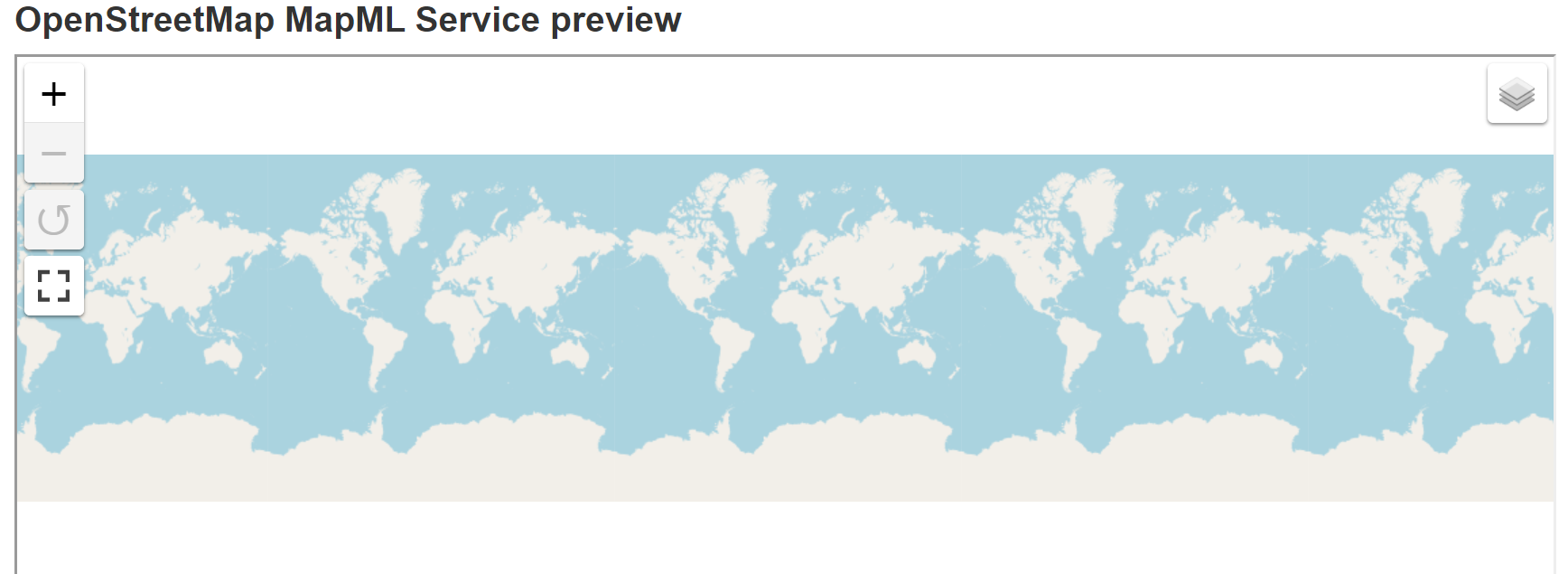
This can be controlled by the Leaflet noWrap option in tiled layers (e.g. M.TemplatedTileLayer), but in WMS based layers, which are custom implemented via the M.TemplatedImageLayer (and probably also a problem in M.TemplatedFeatureLayer s, but I didn't test that), the suggested method for controlling CRS coordinate wrapping in Leaflet doesn't work, so it's probably not a Leaflet problem.